Reality. Reconstructed into Intelligence.
3DF Zephyr
Photogrammetry software solution. Automatically reconstruct 3D models from photos.
Engineering Reality into Actionable Insight
Most workflows do not fail at reconstruction; they fail at turning reconstructed data into insights that can actually drive real-world decisions at scale. 3DF Zephyr by 3DFlow removes fragmented reconstruction pipelines. It unifies images, video, and scanned data into one system. From capture to measurable outputs, everything stays connected. Each dataset is transformed into structured, measurable, and analysis-ready 3D intelligence that can be directly used across workflows. It is not just a 3D photogrammetry software; it is operational intelligence built from reality.
Key Features
Full 3D Reconstruction from Photos
Blazing-Fast Multi-GPU Acceleration
Universal Device & Data Support
Professional GIS, CAD & Survey Outputs
Hybrid Reality Capture Without Trade-offs
In-house Technology
From camera orientation to the texture generation phase, 3DF Zephyr delivers technology that processes faster and scales extensively. Now get full control over all four 3D reconstruction steps, benefiting from a blazing-fast experience provided by Zephyr’s multi-GPU support.
Advanced optimisation algorithms maximise processing efficiency while maintaining high reconstruction accuracy across projects of any scale.
The integrated workflow reduces processing bottlenecks, enabling faster project turnaround and consistent high-quality outputs from start to finish.
From camera orientation to dense point clouds, mesh generation, and texture mapping, each flow is engineered for precision, scalability, and repeatable results.
Just Versatile
Process hundreds of applications, projects and scenarios faster and rapidly reconstruct 3D models more accurately and reliably. Define your goals, and let 3DF Zephyr tune in to your needs and skills.
Flexible data integration and adaptable workflows empower professionals across surveying, engineering, heritage, and mapping applications to achieve accurate results with confidence.
Leverage photogrammetry, laser scans or both inside just one application. From large-scale environments to complex indoor scenes, reconstruction stays consistent, complete, and reliable. No switching tools. No data loss between systems.
Beyond 3D Models
Standard imagery is not always enough to understand reality. 3DF Zephyr processes multispectral data and 360° imagery to unlock deeper environmental and spatial insights.
From NDVI analysis to thermal mapping and spherical reconstruction, every dataset is calibrated, structured, and fully integrated into the pipeline.
Get true orthophotos, Digital Terrain and Surface models (DTM, DSM), stats and project reports. Perform CAD drawing and generate sections, paths and contour lines.
Export your data to the file format that suits you best. From visualisation to analysis, extended reality becomes measurable intelligence. Transform diverse data sources into actionable insights for smarter planning, analysis, and decision-making.
Applications
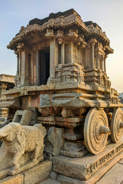
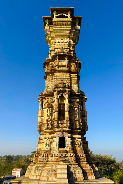
Cultural Heritage & Archaeology
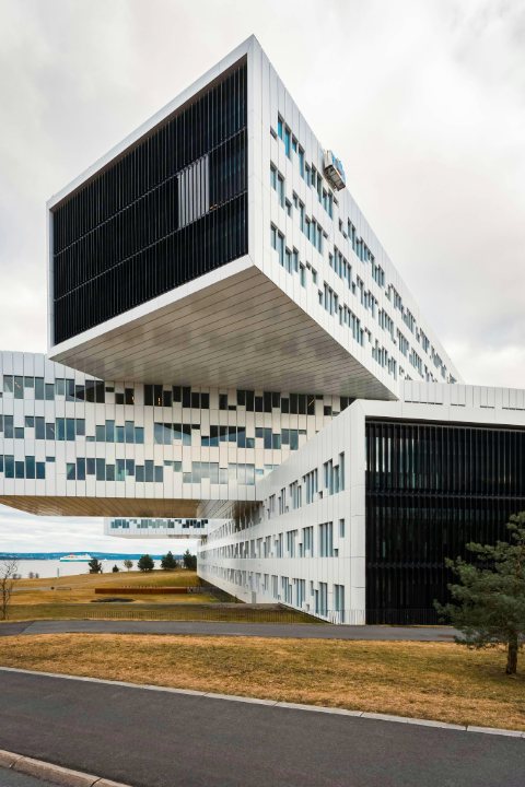
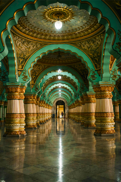
Architecture & Design
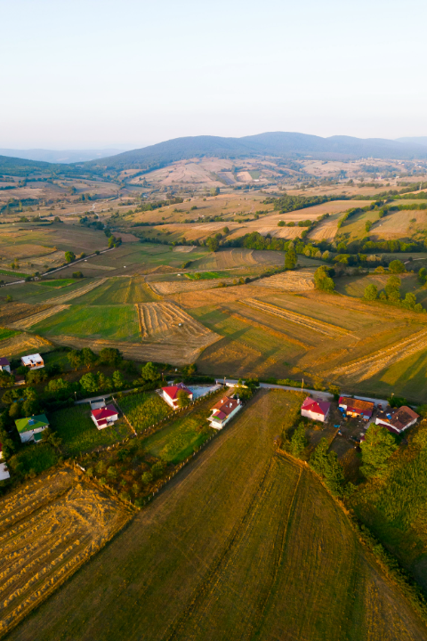
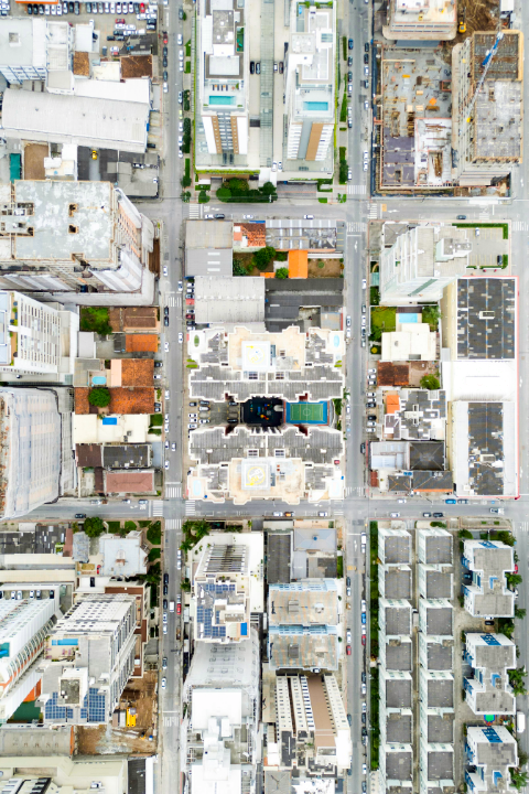
Drone Mapping & Surveying
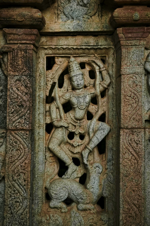
Close-Range Models & Object Scanning
Structure Modelling
Hybrid Photogrammetry
Laser Scanning
360° Spherical & Multispectral Imaging
3D reconstruction is not only about creating 3D models, but also about photogrammetry intelligence. Now bring clarity, speed, and precision across every application. Process your data intelligently to unlock its true value and turn insights into impact.
Ready to reconstruct Reality and unlock intelligence?
Now convert raw capture into accurate, decision-ready 3D intelligence, with Mirai.